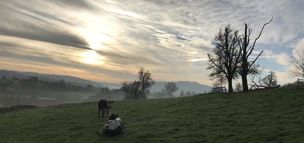
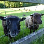
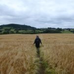
The Cotswold Way is a designated 102 mile National Walking Trail. Starting in the North Cotswolds in Chipping Campden and finishing in Bath at the Abbey, this undulating route follows the natural beauty of the Cotswold escarpment landscape. It passes through picturesque Cotswold towns and villages and if you like spectacular views, this is certainly the walk for you.
During 2017, for a friend’s BIG 50th birthday year, with a group of friends we decided to walk the entire 102 mile route of the Cotswold Way. Due to our busy lifestyles, it was decided that we should walk a section every month with the final walk into Bath taking place in November just time for a celebratory meal an overnight stay and a visit to the famous Christmas market.
Walking the Cotswold Way was an amazing enjoyable adventure and one we felt we should share with you all so that you can replicate it yourselves. Here is a breakdown of the sections we walked and some tips for walking each one.
Please note that all of the sections are hilly so therefore you do need a certain level of fitness to complete them. The route is linear so you will need a car at each end or you need to organise a taxi or find public transport to get back to the start when you finish each section!
Leg One: Chipping Campden to Stanway House Distance: 11.93 miles (19.2k)
Overview
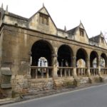
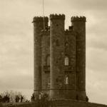
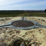
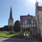
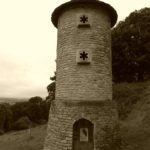
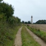
Starting in the beautiful quintessential Cotswold town of Chipping Campden, the route climbs out of the town to Dover’s Hill. The next highlight on the route is the iconic Broadway Tower and the amazing panoramic view. Broadway town is a must to stop for lunch and we thoroughly enjoyed browsing around the shops. The route climbs out of Broadway and on towards the iron age hill fort of Shenway Camp before drooping down into the beautiful village of Stanway and on to the final stop at the Jacobean Manor House, Stanway House.
Tip
Park in the free car & coach park at the end of Chipping Campden. For lunch in Broadway pop into the Lygon Arms a lovely hotel with a great restaurant and menu. We booked a taxi to take us from Stanway House back to the start which worked out well.
Leg Two: Stanway House to Cleeve Hill (Cheltenham) Distance: 11.80 miles (19k)
Overview
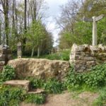
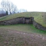
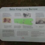
Another long route with lots of ups and downs! From Stanway House you will follow the footpath all the way to the lovely town of Winchcombe. After a wet and cold February walk we stopped for refreshments in a very nice teashop before tackling the climb from the Sudeley Castle Estate all the way up to the Neolithic Long Barrow called Belas Knap. This section ends with a climb up to the highest part of the whole trail, Cleeve Hill Common which can be very bleak in the Winter months as we found out!
Tip
Have a break in Winchcombe and visit a teashop there are a few to choose from and maybe visit Sudeley Castle if you have time.
Leg Three: Cleeve Common to Seven Springs Distance: 8.20 miles (13.2k)
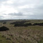
Overview
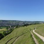
This was one of the shorter routes on our walk. From the peak of Cleeve Common Hill, you will experience spectacular views across Cheltenham and beyond. You will drop down into Bill Smylie’s butterfly reserve. In March, when we passed by unfortunately we didn’t see any butterflies but it would be a lovely place to explore in the Summer. The route finishes at Seven Springs.
Tip
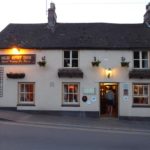
Park at the bottom of the lane leading up to Cleeve Common or on the Common itself. At the end the Seven Springs pub is a nice place to have a drink and a meal if you are peckish!
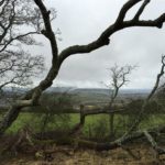
Leg Four: Seven Springs to the Royal William at Cranham Distance: 12.68 miles (20.4k)
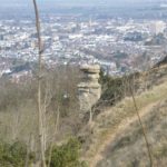
This is the longest section which we walked on the trail. From Seven Springs the path climbs up onto Charlton Kings Common with it’s breath taking views across Cheltenham and the Severn Vale. The trail then follows the escarpment onto Leckhampton Hill where you can look out for the distinctive rock pillar known as the Devil’s Chimney.
Crickley Hill Iron Age fort is nice place to stop and have a break. It has a café, toilets and lots of picnic benches along with yet another panoramic view. The climb up the side of the world renowned Coopers Hill which hosts the annual cheese rolling event and subsequent hill in the woods certainly gets your heart pounding. The walk finishes near to the Royal William Pub.
Tip
Park in the Layby on the main road at Seven Springs. Enjoy a drink at the Royal William at the end.
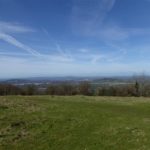
Leg Five: The Royal William to Ebley Mill Distance: 11.74 miles (18.9K)

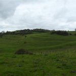
This leg passes through our local area so we know it very well. The start of the walk takes you across Painswick Beacon and down into the lovely Cotswold town of Painswick. The path drops down into the valley before an epic climb up across Edge Common before dropping back down into Stockend Woods. The trail meanders out onto Haresfield Beacon where on a good day you can see over twenty five miles into the distance. On a clear day you can see the Severn Bridges near Bristol and the Black Mountains in Wales. Following the wooded section through Randwick Woods the path drops down into the Stroud Valleys with the final part of the walk following the canal tow path finishing at Ebley.
Tip
You can get the bus from Stroud Bus Station to the start at the Royal William which will save a trip back to the start at the end. There is a nice pub before Edge Common called the Edgemoor Inn. It is serves nice food & drink.
Leg Six: Dudbridge (Stroud) to The Old Spot (Dursley) Distance: 8.7 miles (14K)
Starting in the field just off of the bypass near to Sainsbury’s Supermarket the Cotswold Trail climbs steeply from the start for around a mile to the summit of Selsley Common where you will experience yet more amazing panoramic view across the Severn Vale and out to Wales. After dropping down into the valley the climb up into the Penn Woods leads out to the Coaley Peak view point where you will see a Neolithic Long Barrow. The trail continues before dropping down into the valley before another steep climb up onto the long mound with yet more spectacular views. The decent into Dursley leads you across fields before arriving at the market down where at the end there is yet another lovely pub called the Old Spot.
Tip
Park in the road by Sainsbury’s. Nice picnic areas on route. Enjoy dinner and a drink at the old Spot or at one of the other restaurants in town. If you time it right you can get a local bus from Dursley back to Stroud but beware they do not run late at night and are few and far between.
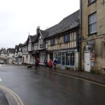
Leg Seven: The Old Spot Dursley – Wotton-under-Edge Distance: 7.2 miles (11.6k)
Overview
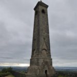
The trail starts with yet another very step climb up the hill from The Old Spot into the woods leading to the Stinchcombe Common and golf course. This section is shorter than the rest but still has some amazing views to admire. The path drops down from the golf course before gradually climbing up to the Tyndale Monument which was built by William Tyndale in 1866 and on towards Wotton-under-Edge where it finishes.
Tip
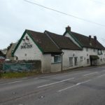
Park in the car park beside the Old Spot. Climb the Tyndale Monument if your legs will let you! If you plan to stay for a while in Wotton Under Edge The Falcon Inn is renowned locally for serving delicious large steaks,
Leg Eight: Wotton-under-Edge – The Dog Inn (Old Sodbury) Distance: 12.05 miles (19.4k)
Overview
After a few short sections leg 8 is another longer walk and there are also lots of climbs to enjoy en-route. By now your legs should be used to hills and you will be feeling we hope very fit. At Hawkesbury Upton, near to the trail you will see the Somerset Monument. The Somerset Monument was built by Lewis Vulliamy in 1846 in memory of Robert Edward Henry Somerset. He was a general at the Battle of Waterloo of 1815, and died in 1842. The walk finishes at the Dog Inn at Old Sodbury.
Tip
Park in the housing estate near to the church in Wotton Under Edge to save paying parking charges and also in the lane near to the Dog Inn if you do not plan on having a drink there at the end.
Leg Nine: The Dog Inn (Old Sodbury) – Cold Ashton Distance: 9.20 miles (14.8k)
Overview
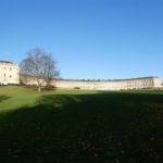
The highlight on this section of the walk for us was the National Trust property, Dyrham Park. https://www.nationaltrust.org.uk/dyrham-park. It is a spectacular late 17th-century mansion, garden and deer park. If you have time, spend some time to take a look around. We spotted some deer whilst walking through the outskirts of the estate when we stopped to have our picnic. Overall this walk is not so hilly as some of the others.
Tip
Dinner and a pint at The Dog at the end is very cosy!
Leg Ten & the Finale to the end at Bath Abbey! Cold Ashton – Bath Abbey Distance: 9.76 miles (15.7k)
Overview
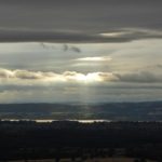
The grand finale and the last trek into Bath will not disappoint you. It is packed with scenic views across Bristol and the Severn Bridges are not too far away. You will pass through the site of the Battle of Lansdowne which was fought in 1643 and also go around the perimeter of the race course.
As you drop down into the outskirts of Bath you think you have seen the back of the hill climbs but don’t be fooled there is a cheeky uphill climb into town which will test your legs towards the end.
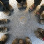
You will pass through the famous Bath Crescent and Circle before arriving at the finish line at Bath Abbey where you will see a plaque on the floor to mark the end of your epic 102 mile walk.
Tip
Park in the layby beside the A46 and get a taxi back to your car when you finish your walk. At the end of our walk we booked a nice apartment via www.booking.com on the outskirts of town and had a nice celebratory meal at Comptoir Libonais. We also explored the Christmas Market and the sites of Bath the next day. It is a beautiful city with lots to see. A fitting place to end the amazing Cotswold Way trail.